FacebookInstagramTwitterWhatsApp

Meteo Borgo San Giovanni tra 10 giorni. Previsioni del tempo, precipitazioni, temperatura e venti

FacebookWhatsappTwitterTelegram

Borgo San Giovanni
Notte
cielo coperto
Mattino
cielo in gran parte nuvoloso
Pomeriggio
prevalentemente soleggiato
Sera
poco nuvoloso
  • 12°

    UV Normale 0

    ore

    cielo in gran parte nuvoloso

    Umidità alta93%

    Raffiche forti16-50 Km/h

    Sud intensoSud

  • 12°

    UV Normale 0

    ore

    cielo coperto

    Umidità alta93%

    Raffiche forti18-51 Km/h

    Sud sud est intensoSud SE

  • 11°

    UV Normale 0

    ore

    cielo coperto

    Umidità alta93%

    Raffiche forti20-51 Km/h

    Sud sud est intensoSud SE

  • 11°

    UV Normale 0

    ore

    cielo coperto

    Umidità alta93%

    Raffiche forti22-51 Km/h

    Est sud est intensoEst SE

  • 11°

    UV Normale 0

    ore

    cielo coperto

    Umidità alta92%

    Raffiche forti19-47 Km/h

    Est sud est intensoEst SE

  • 11°

    UV Normale 0

    ore

    cielo coperto

    Umidità alta92%

    Raffiche forti17-43 Km/h

    Est sud est intensoEst SE

  • 11°

    UV Normale 1

    ore

    cielo coperto

    Umidità alta92%

    Raffiche forti15-40 Km/h

    Est sud est intensoEst SE

  • 12°

    UV Normale 2

    ore

    cielo coperto

    Umidità alta91%

    Raffiche forti13-36 Km/h

    Est sud est intensoEst SE

  • 12°

    UV Normale 3

    ore

    cielo in gran parte nuvoloso

    Umidità alta91%

    Raffiche forti11-32 Km/h

    Est sud est intensoEst SE

  • 13°

    UV Normale 4

    ore

    cielo in gran parte nuvoloso

    Umidità alta90%

    Raffiche forti9-28 Km/h

    Est sud est intensoEst SE

  • 14°

    UV Normale 4

    ore

    cielo in gran parte nuvoloso

    Umidità alta84%

    Raffiche forti9-28 Km/h

    Sud est intensoSud E

  • 15°

    UV Normale 5

    ore

    cielo in gran parte nuvoloso

    Umidità alta78%

    Raffiche forti10-28 Km/h

    Sud est intensoSud E

  • 16°

    UV Elevato 6

    ore

    cielo in gran parte nuvoloso

    Umidità alta72%

    Raffiche forti10-29 Km/h

    Sud intensoSud

  • 18°

    UV Elevato 7

    ore

    cielo in gran parte nuvoloso

    Umidità normale65%

    Raffiche forti10-29 Km/h

    Sud sud ovest intensoSud SO

  • 19°

    UV Elevato 6

    ore

    prevalentemente soleggiato

    Umidità normale59%

    Raffiche forti11-29 Km/h

    Sud sud ovest intensoSud SO

  • 20°

    UV Normale 5

    ore

    prevalentemente soleggiato

    Umidità normale53%

    Raffiche forti11-29 Km/h

    Ovest sud ovest intensoOvest SO

  • 21°

    UV Normale 4

    ore

    prevalentemente soleggiato

    Umidità normale47%

    Raffiche forti12-31 Km/h

    Ovest sud ovest intensoOvest SO

  • 20°

    UV Normale 4

    ore

    prevalentemente soleggiato

    Umidità normale51%

    Raffiche forti13-32 Km/h

    Ovest sud ovest intensoOvest SO

  • 18°

    UV Normale 3

    ore

    prevalentemente soleggiato

    Umidità normale55%

    Raffiche forti14-33 Km/h

    Ovest intensoOvest

  • 17°

    UV Normale 2

    ore

    prevalentemente soleggiato

    Umidità normale60%

    Raffiche forti15-35 Km/h

    Ovest intensoOvest

  • 15°

    UV Normale 1

    ore

    prevalentemente soleggiato

    Umidità normale64%

    Raffiche forti16-36 Km/h

    Ovest intensoOvest

  • 14°

    UV Normale 0

    ore

    poco nuvoloso

    Umidità normale68%

    Raffiche forti17-37 Km/h

    Ovest intensoOvest

  • 14°

    UV Normale 0

    ore

    poco nuvoloso

    Umidità alta72%

    Raffiche forti14-33 Km/h

    Ovest nord ovest intensoOvest NO

  • 13°

    UV Normale 0

    ore

    poco nuvoloso

    Umidità alta75%

    Raffiche forti12-28 Km/h

    Ovest nord ovest intensoOvest NO

  • UV Normale 0

    ore

    cielo in gran parte nuvoloso

    Umidità alta96%

    Raffiche normali3-10 Km/h

    NordNord

Meteo provincia di Lodi
Meteo Nord-Ovest Italia
Oggi

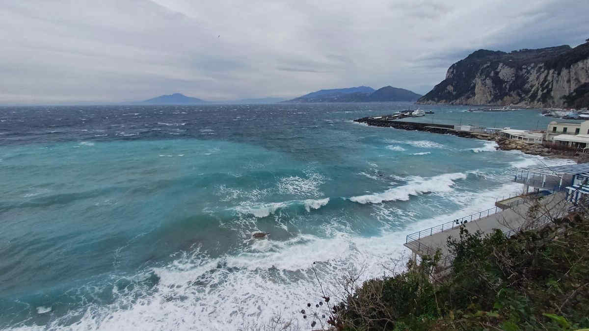
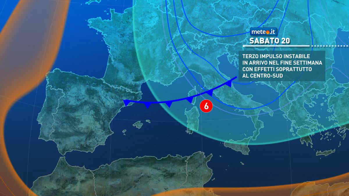
Al mattino cielo sereno o poco nuvoloso. Temperature minime stazionarie o in leggero calo. Nel pomeriggio tempo soleggiato con qualche annuvolamento a ridosso delle Alpi settentrionali dove daranno possibili delle nevicate in serata oltre 1300 metri. Temperature massime in leggero rialzo. Venti in prevalenza deboli, meridionali in Liguria. Mar Ligure poco mosso.

Notizie
TendenzaMeteo, weekend instabile e freddo: piogge in vista anche nel ponte del 25 aprile? La tendenza
Meteo, weekend instabile e freddo: piogge in vista anche nel ponte del 25 aprile? La tendenza
Weekend instabile con vento forte e un clima insolitamente fresco per la stagione. Questa fase meteo insisterà anche nel ponte del 25 aprile?
Mediaset

Ultimo aggiornamento Venerdì 19 Aprile ore 09:35

Copyright © 1999-2020 RTI S.p.A. Direzione Business Digital - P.Iva 03976881007 - Tutti i diritti riservati - Per la pubblicità Mediamond S.p.a. RTI spa, Gruppo Mediaset - Sede legale: 00187 Roma Largo del Nazareno 8 - Cap. Soc. € 500.000.007,00 int. vers. - Registro delle Imprese di Roma, C.F.06921720154